The Pilbara is a region south of the Kimberley that covers half a million square kilometres. When we set out from Sydney, it never occurred to us to take a detour into it. Much of it is inaccessible, and we associated it largely with iron ore mining, remote Aboriginal communities, and the Great Sandy Desert. We had planned to track the coastline as we travelled south from Broome to Exmouth.
The idea of taking a detour into the Pilbara was sparked by a conversation with a man who worked at a gallery in Darwin that specialised in Aboriginal art. We got chatting with him about travel, and foreshadowed our journey further west. He gave us a vivid and rapturous description of Karijini National Park, which is located in the Eastern Pilbara, and he urged us to visit it. We didn’t think much more about it at the time, but the seed was sown.
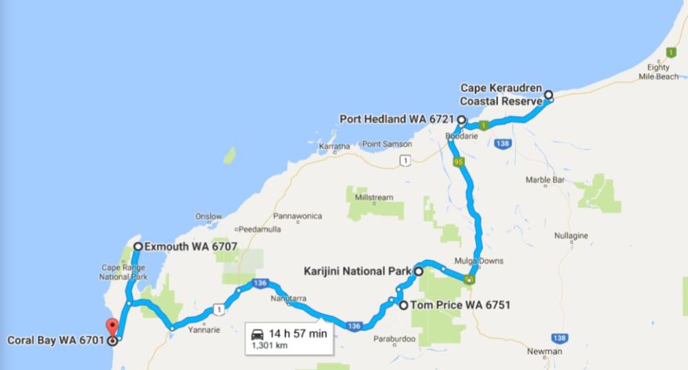
As we completed our journey through the Kimberley we learned that Karijini was readily accessible by sealed roads, but a visit would entail a detour of over 600 km. The more we learned about this place, however, the keener we became to visit it.
Our detour would take us from Cape Keroudren, at the southern tip of Eighty Mile Beach, east to Port Hedland, which is the biggest town in the region. From Port Hedland we would leave the coast and head south on the road to Newman, as far as Karajini National Park, where we planned to stay as long as our provisions lasted. We would then head east towards to coast again, and join Highway 1 again near Exmouth Gulf.
The beauty of the Kimberley region had awed us, so we were keen to set eyes on the Pilbara’s best-kept secret.
Next post: Cape Keraudren to Karajini
